

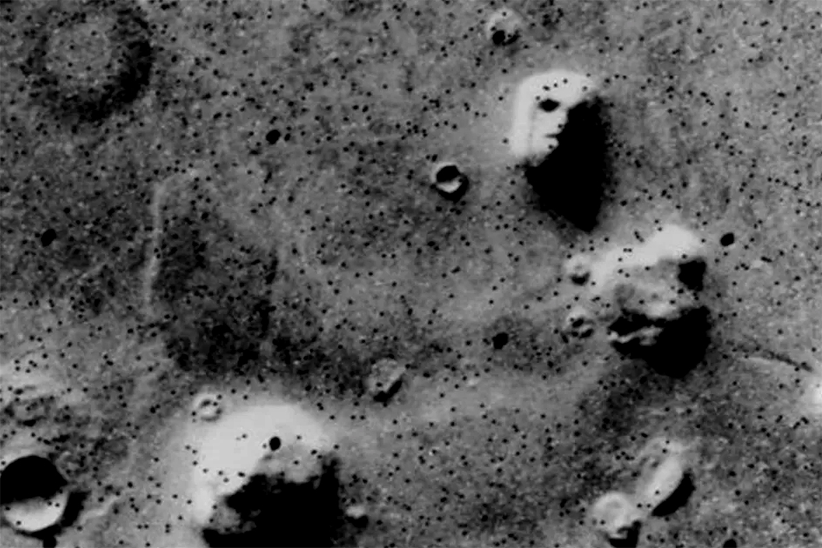
Additionally, on 21 September 2006, ESA's Mars Express spacecraft again imaged the Cydonia region and produced perspective views showing the rock formations in great detail. The images have a resolution of 13.5 m per pixel and were colourised using 3 colour channels - HRSC. The perspective views were calculated from a digital terrain model derived from the stereo channels. As seen in the images below, the "face of Mars" is an example of how new technologies are dramatically improving the quality of space images, and eliminating misunderstandings caused by blurry images of the past.
 |
 |
 |
And the “pyramids”?
The alleged Martian pyramids are described as symmetrical formations very close to the "face", presumably the remains of a city that was home to an ancient civilization. They are often attempted to appear aligned in one way or another with the "face". Although the images of the Viking mission show that these formations have a certain pattern, when looking at more recent images it becomes evident that these are actually plateaus of similar height to the "face", although they have a more regular pattern, similar to dunes. It is thought that they may correspond to eroded formations that protrude from the ground, which would be a probable sign that, in the past, the Cydonia region was located near a beach of liquid water. It is worth mentioning that, with the high-resolution images obtained in 2001 and 2006, if there were artificial structures such as pyramids or even small houses, these would be easily recognizable, since the objects are recognizable when their image is 3 times the size of the pixel.
 |
.") |
 |